Remote worker
55
77% coverage
Needs bandwidth and an airport more than it needs a pharmacy. Will trade services for cheap space and a fast train.
Missing: community, cost
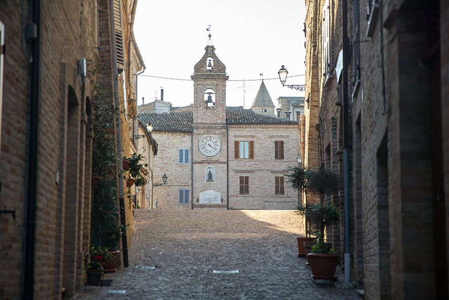
FM · Marche
Photo Archeologia91 · CC BY-SA 4.0
The feeling
Monte Rinaldo sits in FM, Marche. We have not written this village up yet — what follows is only what we can measure, with every source named.
7 of 9 axes measured (78% coverage). No data yet for cost, community — those axes are excluded from every score on this page, not counted as zero.
191Mbps
Average download
Measured across 56 tests · 36 ms latency
68km
To the airport
Aeroporto "Raffaello Sanzio" di Ancona-Falconara (AOI)
123days
Clear skies a year
July averages 24.0°C
22km
To the sea
Rail station 19 km away
How it scores
Read low numbers as character, not failure — but read them.
Poor
Daily needs in the village itself. Most daily errands mean leaving the village
Good
How reachable the outside world is. Reachable, with some planning
Poor
Is the population holding or draining away. The population is draining away
Poor
Signs of life: bars, places to eat, places to stay. Very little open in the evening
Good
Sun, winter, summer. Bright, mild and long in the shoulder months
Excellent
Measured internet speed. Fast enough for anything you do online
Very good
Air quality against WHO guidelines. Clean air by WHO guidelines
A year here
January averages 4.8°C and July 24.0°C.
34days
Above 30°C
29days
Of frost
123days
Clear days
The air
A bar past the line means the annual mean exceeds the WHO guideline for that pollutant.
PM2.5
8.3 µg/m³ · 1.66× guideline
Above the WHO annual guideline (marked)
PM10
11.8 µg/m³ · 0.79× guideline
Within the WHO annual guideline (marked)
NO₂
3.0 µg/m³ · 0.29× guideline
Within the WHO annual guideline (marked)
A note on the data
33 days a year exceed the WHO daily PM2.5 guideline. That is normal for central Italy and worth knowing anyway.
Daily life
Counted inside the comune boundary from OpenStreetMap.
0
Groceries
1
Bars & cafés
0
Restaurants
0
Pharmacies
0
Banks & ATMs
0
Places to stay
0
Schools
2
Sports grounds
0
Doctors' surgeries
0
Coworking
A note on the data
Only 10 features are mapped in this comune, so a zero above may mean "not mapped yet" rather than "not there". We show the count rather than guess.
Getting out
Distances are straight-line unless labelled as a drive. We never mix the two.
Rail station
Ascoli Piceno
19 km
Motorway
unnamed toll gate
28 km
Airport
Aeroporto "Raffaello Sanzio" di Ancona-Falconara (AOI)
68 km
The sea
22 km
Ski lift
unnamed lift/piste
23 km
Drive to Rome
263 km
3 h 5 min
Drive to Florence
294 km
4 h 58 min
Drive to Milan
515 km
5 h 25 min
Drive to Naples
375 km
5 h 33 min
The honest part
On current births and deaths alone, the population changes by -26.9% over twenty years. It is a projection, not a forecast — no migration is modelled.
Mean age
52.9
Over 65
36 %
Under 15
8 %
A note on the data
Only 10 points of interest are mapped in OpenStreetMap here. Zero counts below are as likely to mean 'not mapped yet' as 'not there'.
Who it fits
Each score weights the axes differently. Coverage says how much of that weighting we could actually fill — a score built on fewer axes is a weaker claim.
55
77% coverage
Needs bandwidth and an airport more than it needs a pharmacy. Will trade services for cheap space and a fast train.
Missing: community, cost
43
72% coverage
Wants a doctor nearby, a hospital that exists, sun, a house that costs less than the flat back home, and other foreigners to talk to.
Missing: community, cost
40
59% coverage
Chasing price per square metre. Tolerates isolation, but a village that is emptying fast is a house that will never resell.
Missing: community, cost
Nearby
Compare on one thing
Sources
Last refreshed 2026-07-26.
ISTAT POSAS (residents by age and sex, per comune)
demo.istat.it
2026
Italian Wikipedia (CC BY-SA 4.0)
it.wikipedia.org
—
Model: cohort-component, no migration. ISTAT POSAS (residents by age and sex, per comune) 2026 + Italian life table 2024 + ITI3 fertility 2024 (TFR 1.11)
ec.europa.eu
2026+20y
Ookla Open Data, fixed broadband tiles (CC BY-NC-SA 4.0)
github.com
2026Q1
Open-Meteo air quality (CAMS European reanalysis)
open-meteo.com
2024
Open-Meteo ERA5 archive (2015-2024 daily reanalysis)
open-meteo.com
2015/2024
OpenStreetMap (Overpass)
—
OpenStreetMap (Overpass)
www.openstreetmap.org
—
OSRM routing over OpenStreetMap
router.project-osrm.org
—
OSRM routing over OpenStreetMap
—
Wikidata (P1082/P2046/P2044, sourced from ISTAT)
www.wikidata.org
—
Field-by-field definitions and caveats live in the data dictionary.