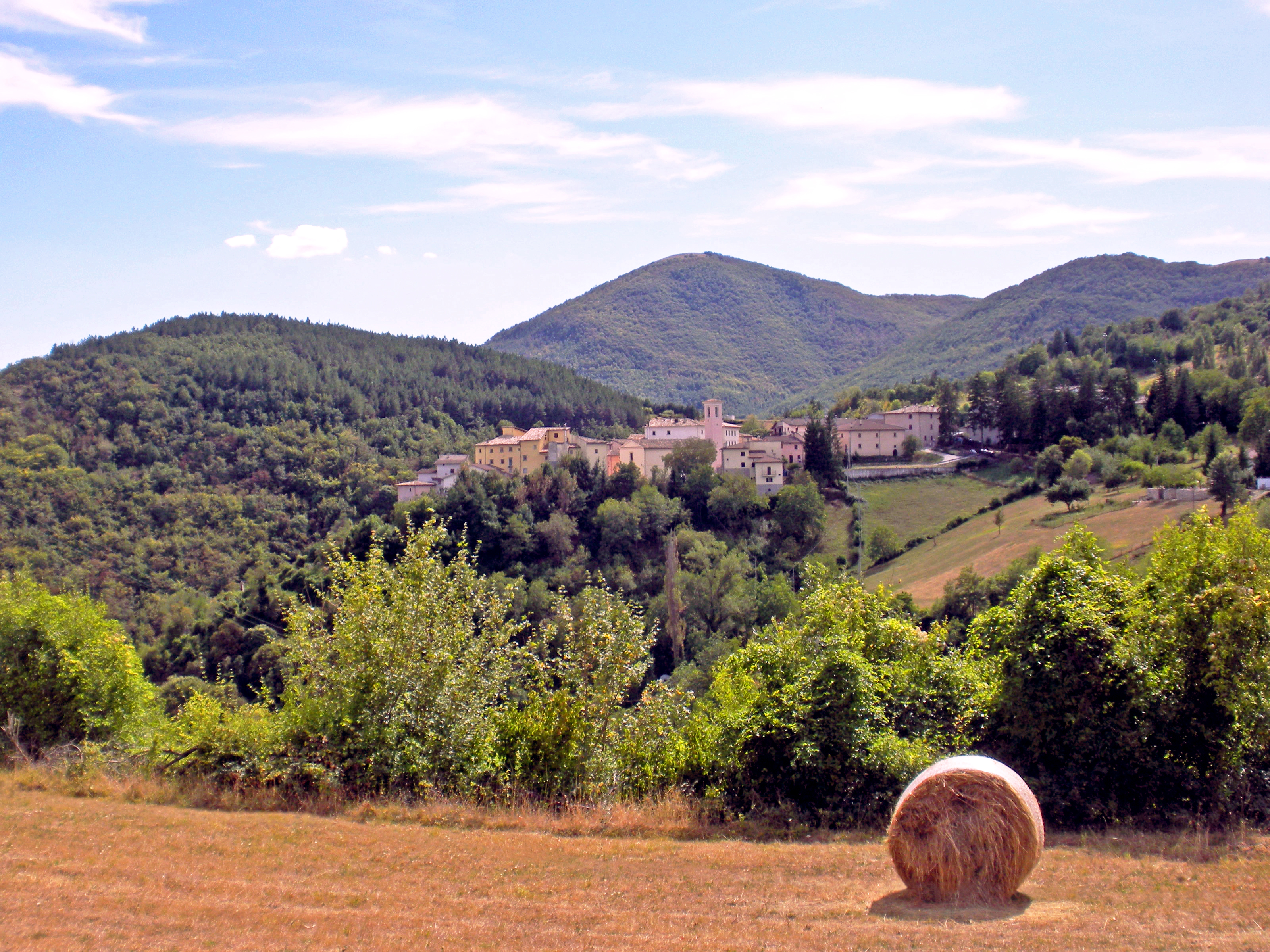
Poggiodomo, PG

PG · Umbria

Poggiodomo

Residents
81
Elevation
974 m
Area
40.1 km²

Photo Scrollghost · Public domain

The short version

Poggiodomo is a village of around 80 people high in the mountains at 974 m in Umbria.

The population is ageing: on births and deaths alone there would be around 40 people fewer here in twenty years.

We could measure 6 of the 9 things we look at in a village. We have nothing yet on the weather, air quality and house prices, so those are left out of every score below rather than counted as zero.

Read the history of Poggiodomo on Italian Wikipedia

83km

To the sea

On the map

Where this actually is

The village in Italy, then in its region with the nearest others we have measured.

Poggiodomo is in Umbria, marked in red.
20 km
Poggiodomo in Umbria, one of 92 villages measured in the region. Each dot is one of them; the 6 nearest are darker, and named below.

Boundaries from ISTAT administrative limits via openpolis/geojson-italy, licensed CC BY 4.0, simplified for drawing. Position from Wikidata. Distances are straight-line.

Getting in and out

How you reach the rest of the world

Three ways out: the train, the motorway, the plane. Each one leads with how long it takes to reach it by car — ISTAT measures that for every comune in Italy — and then what it gets you once you are there.

By air

1 h 8 min

drive to the nearest airport

Rome Fiumicino FCO · 117 km

Flies to Spain, France, the USA, Germany and 47 more.

51 countries in all.

Rome Ciampino CIA · 107 km

Flies to the UK, Poland, Romania, Hungary and 17 more.

21 countries in all.

Perugia PEG · 53 km

Flies to the UK, Albania, Belgium, Malta and 3 more.

7 countries in all.

Countries with a scheduled route that carried real passengers in 2024, from Eurostat. Airlines add and drop routes; check before you book a life around one.

By road

1 h 51 min

drive to the motorway (Orte)

Rome

144 km

Florence

241 km

Milan

538 km

Naples

302 km

By rail

42 min

drive to the nearest station

Milan

direct from Orte

3 h 7 min

53 km to that station

Naples

direct from Orte

2 h 54 min

53 km to that station

Fastest direct train in the published Trenitalia timetable — one train, no changes. A city missing from this list is one you can still reach, but only by changing. Italo is not in the open feed, so on Milan and Naples the real best may be quicker.

How it scores

How this village does, point by point

Each line is one question, answered from measured data and rated from poor to excellent. A low mark does not mean a bad village. It means you would have to drive, or wait, or put up with something.

Shops and everyday needs

Poor

Daily needs in the village itself. Most daily errands mean leaving the village

Getting anywhere else

Poor

How reachable the outside world is. Remote — the outside world is a commitment

Is the village emptying?

Poor

Is the population holding or draining away. The population is draining away

Somewhere to eat or stay

Poor

Signs of life: bars, places to eat, places to stay. Very little open in the evening

Internet

Excellent

Fibre reach and measured speed. Fibre nearly everywhere, and fast where anyone has measured it

Other foreigners here

Poor

Foreigners already living there. Few foreign residents already here

Is Poggiodomo the right one, though?

It is one of 5,664 villages measured the same way. Answer six questions and we will rank every one of them against what you actually want.

Find your village

Who else is here

The people already from somewhere else

Resident foreigners by citizenship, from ISTAT's 1 January 2025 count. Residents, not holiday-home owners — someone who registered with the town hall.

Foreign residents

8.3% of Poggiodomo

7

From northern and western Europe, or the anglosphere

0.0% of residents

0

Largest groups

Romania

3

Bulgaria

2

Poland

1

Ukraine

1

Daily life

What is actually in the village

Counted inside the municipal boundary, from OpenStreetMap.

1

Post offices

1

Schools

1

Places to stay

4

Sports grounds

Nothing else is mapped here yet — which is a gap in OpenStreetMap, not necessarily a gap in the village.

A note on the data

Only 21 features are mapped in this comune. Anything not listed above may simply be unrecorded rather than absent, so we show what was counted and leave the rest blank.

What there is to do

Living there, not just arriving

Not how you leave — what is within reach on a free day. Every distance here is a straight line, and in the Apennines the road is much longer.

The sea

Well inland

83 km away

Measured to open water against the coastline itself — which is not the same as a beach you can park at.

The nearest lift

Lifts within reach

18 km away

Seggiovia del Monte Tilia. A lift or a marked downhill piste in OpenStreetMap. Small Apennine stations open and close with the snow.

Ski areas within reach

  • Area Sciistica Ussita Frontignano8 lifts · 29 km
  • Campo Imperatore2 lifts · 62 km

Named ski areas in OpenStreetMap, biggest first rather than nearest. Lift counts are aerialways mapped inside the area — drag lifts included, so a number in the single digits is a village station, not a resort.

A note on the data

No sagre yet. Italy has no national open dataset of village festivals — Lombardia publishes one, Abruzzo, Marche and Umbria do not, so for now the calendar of a 974 m village is something you have to ask the comune for.

The honest part

Who lives here, and for how much longer

Counting births and deaths only, the population would change by -54.0% over twenty years. It assumes nobody moves in or out, so treat it as the direction of travel rather than a prediction.

today+5y+10y+15y+20y8137

Mean age

64.6

Over 65

58 %

Under 15

4 %

A note on the data

Only 21 points of interest are mapped in OpenStreetMap here. Zero counts below are as likely to mean 'not mapped yet' as 'not there'.

A note on the data

No Speedtest samples within 3 km, so there is no measured internet speed for this village. That absence is itself a signal about how many people are online here.

Who it fits

Three ways of wanting a village

The same village suits three people very differently, because they want different things from it. Where we are missing data that one of them cares about, we say so — a verdict built on less is worth less.

Remote worker

Thin

Based on 73% of what matters to them

Needs bandwidth and an airport more than it needs a pharmacy. Will trade services for cheap space and a fast train.

We have not measured air quality, the weather and house prices in this village, so this verdict leaves them out.

Retiree / semi-retired

Poor

Based on 65% of what matters to them

Wants a doctor nearby, a hospital that exists, sun, a house that costs less than the flat back home, and other foreigners to talk to.

We have not measured air quality, the weather and house prices in this village, so this verdict leaves them out.

Cheap-house renovator

Poor

Based on 51% of what matters to them

Chasing price per square metre. Tolerates isolation, but a village that is emptying fast is a house that will never resell.

We have not measured air quality, the weather and house prices in this village, so this verdict leaves them out.

Nearby

The next villages along

Closest first, measured in a straight line. They may be over a regional border — a border is not a distance.

There are 5666 villages measured so far. Have them ranked for you, or search all of them.

Every number on this page came from somewhere

15 sources · last refreshed 2026-07-31

AGCOM — ultra-broadband coverage by municipality

geo.agcom.it

Eurostat air transport statistics, and OurAirports

ec.europa.eu

2024-12-31

ISTAT — municipal accessibility to transport infrastructure (2023)

www.istat.it

2022-12-31

ISTAT — resident population by citizenship

demo.istat.it

2025-01-01

ISTAT POSAS (residents by age and sex, per municipality)

demo.istat.it

2026

Italian Wikipedia (CC BY-SA 4.0)

it.wikipedia.org

Model: cohort-component, no migration. ISTAT POSAS (residents by age and sex, per municipality) 2026 + Italian life table 2024 + ITI2 fertility 2024 (TFR 1.11)

ec.europa.eu

2026+20y

OpenStreetMap (Overpass)

www.openstreetmap.org

OpenStreetMap (Overpass)

www.openstreetmap.org

OSRM routing over OpenStreetMap

127.0.0.1

OSRM routing over OpenStreetMap

Trenitalia timetable via the Italian National Access Point (NeTEx)

www.cciss.it

Wikidata (P1082/P2046/P2044, sourced from ISTAT)

www.wikidata.org

2017-01-01

Wikidata (P1082/P2046/P2044, sourced from ISTAT)

it.wikipedia.org

Wikidata P18 / Wikimedia Commons

commons.wikimedia.org

Field-by-field definitions and caveats live in the data dictionary.

Six questions

Which of the five thousand is yours?

Answer six questions and we rank all 5,664 measured Italian villages against them. Your top three appear straight away, no email.

Find your village